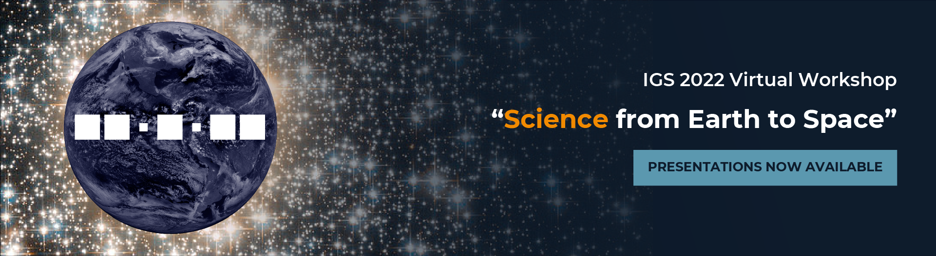
Our planet is dynamic and ever-changing, and so it seems, is our IGS Workshop planning process, as well. Due to circumstances beyond our control, we will unfortunately need to move our 2022 Workshop to a fully virtual format.
While we will all miss seeing each other in person, we will use this change of circumstances to help us refocus the IGS Workshop back to being just that – a community workshop. We will be operating on a compressed schedule to try to be inclusive to as many time zones as possible, and condensing our workshop program to aspects that are the most critical to the function of our Service, specifically a small number of keynote presentations by luminaries and innovators in our community, supported by a comprehensive agenda of working group and/or topical collaboration sessions. The emphasis will be on bringing our community together to discuss key issues and brainstorm the next steps toward a multi-GNSS IGS in service to our global community.
The virtual workshop will take place, as scheduled, the week of 27 June to 1 July, 2022. Key changes include:
- Live Keynote presentations
- Targeted WG/topical splinter sessions convened by IGS Working Group Chairs and community leaders
- Plenaries/posters will not be held during this workshop, but are effectively already taking place (virtually) via the Tour de l’IGS Mini Workshop Series; the next Tour de l’IGS is planned for late April.
- We will plan to hold additional/enhanced sessions at the December 2022 AGU for in-person presentations, an Open AM/WG Meeting, and 2022 Workshop networking event.
We hope that this proposed workshop program will help the IGS workshop return to its unique place among our regular meetings, adding value and impact to our profession.
Please check back periodically for additional event updates.
Agenda for the week
| Time (US PT) | Time (UTC) | Time (Tokyo) | Day 1 Schedule |
|---|---|---|---|
| 06:00 | 13:00 | 22:00 | Logistics, Welcome Remarks |
| 06:30 | 13:30 | 22:30 | Infrastructure Committee (IC), Data Centers (DC) and RINEX |
| Clock Product | |||
| 08:00 | 15:00 | 00:00 | Long Break |
| 13:00 | 20:00 | 06:00 | Antenna |
| Ionosphere | |||
| 14:30 | 21:30 | 07:30 | Adjourn |
Discussion Overview
Infrastructure Committee (IC), Data Centers (DC) and RINEX
Key Technical Items to be discussed by WG, and desired outcomes
- Vision of the IGS Network
- Vision of the IGS Data Infrastructure (Security, Data Storage, Data Access)
- RINEX 4.00: Current status and transition plan
Relevant pre-reading or other preparatory work for participants to do before attending the WG session
- IGS Network Whitepaper
- IGS Data Centre Whitepaper
- IGS CORS Guidelines
- IGS Data Centre Guidelines
- RINEX 4.00 format description
- RINEX 4.00 transition plan
References/Related Links
- Infrastructure Committee
- Data Centers
- RINEX Working Group
- Tour de l’IGS 2nd Stop: Infrastructure
- How to join the committee mailing list
- IGS Workshop 2018 Recommendations Infrastructure Committee
- IGS Workshop 2018 Summary
Clock Product
Key Technical Items to be discussed by WG, and desired outcomes
- Development of multi-GNSS clock solutions for core IGS products
- Parallel development of new IGR reference time
- Leap second statement for contribution to the CCTF at the end of June
Relevant pre-reading or other preparatory work for participants to do before attending the WG session
- Final statement on leap seconds
- Results of the Multi-GNSS clock products
References/Related Links
Antenna
Key Technical Items to be discussed by WG, and desired outcomes
- IGS20: Creation of the IGS20 antenna models (45min)
- Update of the status
- Extension of the IGS20 related ANTEX file with BeiDou and QZSS satellite antenna pattern
- Update / adding new antenna and receivers to the IGS database (rcvr_ant.tab, antenna.gra, igsXX.atx) (15min)
- Restricting new antennas / receivers to the needs of the IGS and its affiliated partners (e.g. EUREF)
- Status / discussion of the ANTEX 2.0 format (15min)
- Varia (15min)
Relevant pre-reading or other preparatory work for participants to do before attending the WG session
- None
References/Related Links
Ionosphere
Key Technical Items to be discussed by WG, and desired outcomes
- IGS real-time service for global ionospheric total electron content modeling
- IGS ROTI maps
- Current Status and its extension towards equatorial region and southern hemisphere
- Towards cooperative global mapping of the ionosphere
- Fusion feasibility for IGS and IRI with global climate VTEC maps
- From the VTEC GIMs to the storm index GIMs.
- The VTEC GIMs as a reliable source of VTEC gradient information
- Influence of the temporal resolution in the VTEC GIM performance
Relevant pre-reading or other preparatory work for participants to do before attending the WG session
- IGS real-time service for global ionospheric total electron content modeling
- Zishen Li, Ningbo Wang, Manuel Hernández-Pajares, Yunbin Yuan, Andrzej Krankowski, Ang Liu, Jiuping Zha, Alberto García-Rigo, David Roma-Dollase, Heng Yang, Denis Laurichesse, Alexis Blot, IGS real-time service for global ionospheric total electron content modeling, Journal of Geodesy (2020) 94:32, doi.: 10.1007/s00190-020-01360-0
- Qi Liu, Manuel Hernández-Pajares, Heng Yang, Enric Monte-Moreno, David Roma-Dollase, Alberto García-Rigo1, Zishen Li, Ningbo Wang, Denis Laurichesse6 Alexis Blot, Qile Zhao, Qiang Zhang, André Hauschild, Loukis Agrotis, Martin Schmitz, Gerhard Wübbena, Andrea Stürze, Andrzej Krankowski, Stefan Schaer, Joachim Feltens, Attila Komjathy, and Reza Ghoddousi-Fard, The cooperative IGS RT-GIMs: A reliable estimation of the global ionospheric electron content distribution in real time, Earth Syst. Sci. Data, 13, 4567–4582, 202, doi.: 10.5194/essd-13-4567-2021
- Zishen Li, Ningbo Wang, Ang Liu, Yunbin Yuan, Liang Wang, Manuel Hernández-Pajares, Andrzej Krankowski, Hong Yuan, Status of CAS global ionospheric maps after the maximum of solar cycle 24, Satellite Navigation, volume 2, 19 (2021), doi: 10.1186/s43020-021-00050-2
- Wen Li; Zishen Li; Ningbo Wang; Ang Liu; Kai Zhou; Hong Yuan; Andrzej Krankowski, A satellite-based method for modeling the ionospheric Slant TEC from GNSS observations: Algorithm and Validation, GPS Solutions, 2022, 26:14, doi: 10.1007/s10291-021-01191-2
- IGS ROTI maps
- Iurii Cherniak, Irina Zakharenkova, Andrzej Krankowski, ROTI Maps: Current Status and Its Extension towards Equatorial Region and Southern Hemisphere, Sensors 2022, 22(10), 3748; doi.: 10.3390/s22103748Iurii Cherniak, Irina Zakharenkova, Development of the Storm-Induced Ionospheric Irregularities at Equatorial and Middle Latitudes During the 25–26 August 2018 Geomagnetic Storm, 2022, Space Weather, 20, e2021SW002891, 2022, doi.: 10.1029/2021SW002891
- Kacper Kotulak, Andrzej Krankowski, Adam Froń, Paweł Flisek, Ningbo Wang, Zishen Li, Leszek Błaszkiewicz, Sensors, 2021, 21, 4325. doi: 10.3390/s21134325
- Irina Zakharenkova, Iurii Cherniak, Andrzej Krankowski, Ground-Based GNSS and Satellite Observations of Auroral Ionospheric Irregularities during Geomagnetic Disturbances in August 2018, Sensors, 2021, 21, 7749. doi: 10.3390/s21227749
- Irina Zakharenkova, Iurii Cherniak, Effects of storm-induced equatorial plasma bubbles on GPS-based kinematic positioning at equatorial and middle latitudes during the September 7–8, 2017, geomagnetic storm, GPS Solutions (2021) 25:132 doi.: 10.1007/s10291-021-01166-3
- Kacper Kotulak, Irina Zakharenkova, Andrzej Krankowski, Iurii Cherniak, Ningbo Wang and Adam Fron, Remote Sensing, 2020, 12(16), 2634; doi.: 10.3390/rs12162634
- Towards cooperative global mapping of the ionosphere
- Adam Froń, Ivan Galkin, Andrzej Krankowski, Dieter Bilitza, Manuel Hernández-Pajares, Bodo Reinisch, Zishen Li, Kacper Kotulak, Irina Zakharenkova, Iurii Cherniak, David Roma Dollase, Ningbo Wang, Paweł Flisek and Alberto García-Rigo, Towards Cooperative Global Mapping of the Ionosphere: Fusion Feasibility for IGS and IRI with Global Climate VTEC Maps, Remote Sensing. 2020, 12(21), 3531; doi.: 10.3390/rs12213531
- Ivan Galkin, Adam Froń, Bodo Reinisch, Manuel Hernández-Pajares, Andrzej Krankowski, Bruno Nava, Dieter Bilitza, Kacper Kotulak, Paweł Flisek, Zishen Li, Ningbo Wang, David Roma Dollase, Alberto García-Rigo and Inez Batista, Global Monitoring of Ionospheric Weather by GIRO and GNSS Data Fusion, Atmosphere 2022, 13(3), 371; doi.: 10.3390/atmos13030371
- From the VTEC GIMs to the storm index GIMs.
- Liu, Q., Hernández‐Pajares, M., Lyu, H., Nishioka, M., Yang, H., Monte‐Moreno, E., … & Orús‐Pérez, R. (2021). Ionospheric Storm Scale Index Based on High Time Resolution UPC‐IonSAT Global Ionospheric Maps (IsUG). Space Weather, 19(11), e2021SW002853.
- The VTEC GIMs as a reliable source of VTEC gradient information
- Liu, Q., Hernández‐Pajares, M., Yang, H., Monte‐Moreno, E., García‐Rigo, A., Lyu, H., … & Orús‐Pérez, R. (2022). A New Way of Estimating the Spatial and Temporal Components of the Vertical Total Electron Content Gradient Based on UPC‐IonSAT Global Ionosphere Maps. Space Weather, 20(2), e2021SW002926.
- Influence of the temporal resolution in the VTEC GIM performance
- Liu, Q., Hernández-Pajares, M., Lyu, H., & Goss, A. (2021). Influence of temporal resolution on the performance of global ionospheric maps. Journal of Geodesy, 95(3), 1-16.
References/Related Links
| Time (US PT) | Time (UTC) | Time (Tokyo) | Day 2 Schedule |
|---|---|---|---|
| 06:00 | 13:00 | 22:00 | Multi-GNSS |
| Tide Gauge (TIGA) | |||
| 07:30 | 14:30 | 23:30 | Long Break |
| 13:00 | 20:00 | 06:00 | Keynote 1: Glen Mattioli, Ph.D., UNAVCO
“The role of UNAVCO and the GAGE Facility in Supporting the IGS and Global Geodesy: Current status, Upcoming Changes, and Ongoing Challenges” |
| 14:00 | 21:00 | 07:00 | Satellite Vehicle Orbit Dynamics |
| Troposphere | |||
| 15:30 | 22:30 | 08:30 | Adjourn |
Discussion Overview
Multi-GNSS
Key Technical Items to be discussed by WG, and desired outcomes
- Transfer of MGEX products to standard IGS product directory
- Multi-GNSS product combination
- Orbit/clock product comparison and required harmonization
- Review of past work on orbit/clock combination (ACC, GFZ, Wuhan Univ., iGMAS)
- Discussion of preferred concept for multi-GNSS orbit combination (constellations, Helmert transformation, VCE, EOPs, weighting)
- Discussion of clock combination concept (system time, GLONASS handling)
- Others
- Metadata SINEX file: distribution, format description
- IGS support for GPS L1/L5 users (antex, orbit, clock)
Relevant pre-reading or other preparatory work for participants to do before attending the WG session
- Beutler G, Kouba J, Springer TA (1995) Combining the orbits of the IGS analysis centers. Bull Geodesique 69:200–222
- Kobel C. S., Arnold D., Jäggi A. (2019). Combination of precise orbit solutions for Sentinel-3A using Variance Component Estimation. Advances in Geosciences 50:27-37. https://doi.org/10.5194/adgeo-50-27-2019
- Mansur G, Sakic P, Männel B, Schuh H. (2020) Multi-constellation GNSS orbit combination based on MGEX products. Advances in Geosciences 50:57-64. https://doi.org/10.5194/adgeo-50-57-2020
- Mansur G., Sakic P., Brack A., Männel B., Schuh H. (2020). Combination of GNSS orbits using variance component estimation. Preprint https://doi.org/10.31223/X5MK64
- Sakic P., Mansur G., Männel B. (2020) A prototype for a Multi-GNSS orbit combination; European GNSS Conference. https://doi.org/10.23919/ENC48637.2020.9317316
- Zhou W, Cai H, Chen G, Jiao W, He Q, Yang Y (2022). Multi-GNSS Combined Orbit and Clock Solutions at iGMAS. Sensors. 22(2):457. https://doi.org/10.3390/s22020457
- Banville S, Geng J, Loyer S, Schaer S, Springer T, Strasser S (2020). On the interoperability of IGS products for precise point positioning with ambiguity resolution. Journal of Geodesy 94:010. https://doi.org/10.1007/s00190-019-01335-w
- IGS Satellite Metadata File Description (15 June, 2022 Draft)
References/Related Links
Tide Gauge (TIGA)
Key Technical Items to be discussed by WG, and desired outcomes
- Review the status (e.g., coverage) of the TIGA-repro3 contribution, do we meet the requirements of the community (coverage, stability, “products”)
- Need of a dedicated TIGA combination using additional solutions
- Discuss ways to improve the situation with leveling TGBM/ARP
- Impact of multi-GNSS combinations on long-term homogeneity of the vertical of GPS-only time series (req. sub-mm/a) at tide gauges
Relevant pre-reading or other preparatory work for participants to do before attending the WG session
-
- IOC manuals on Sea Level (IOC Manuals and Guides No. 14: Volumes I–V, No. 83: Volume I): https://gloss-sealevel.org/library/manuals-guides
- IGS CORS Guidelines
- IGS Data Center Guidelines
- IGS Monumentation-Recommendations: https://igs.org/station-resources/#monumentation-recommendations
- Review the Service of (the TIGA Data Center) www.sonel.org
- Leveling information: https://www.sonel.org/-Stability-of-the-datums-.html?lang=e
- GNSS@TG network: https://www.sonel.org/-GPS-.html?lang=en
- Suggesting new station: https://www.sonel.org/spip.php?page=part_cgpstg
- Access to time series: e.g., https://www.sonel.org/spip.php?page=gps&idStation=639
- Review the usefulness of the tide gauge related information at https://network.igs.org/ (e.g., https://igs.org/imaps/station.php?id=COCO00AUS)
TIGA-WG charter, update if needed
References/Related Links
- TIGA Data Center
- Global Ocean Observing System (GLOSS)
- Permanent Service for Mean Sea Level
- IGS Tide Gauge (TIGA) Working Group
- Associate Membership Meeting 2021 – TIGA
- IGS Workshop 2018 Recommendations Tide Gauge (TIGA)
Satellite Vehicle Orbit Dynamics
Key Technical Items to be discussed by WG, and desired outcomes
- Analyze if there are any satellite type systematics in the repro3 results. Also include recent solutions to have a look at the GPS Block III satellites. Also to include an in-depth analysis of orbit modeling issues and EOP errors.
- Compare these systematics to what we saw with the repro 2. There should be a clear improvement visible. The Geocenter results as computed by Paul Rebischung clearly show improvements!
- Request from each of the (repro) ACs information regarding what they did improve orbit modeling wise for repro 3 and/or routine processing (e.g. based on the 2018 GFZ Potsdam workshop and SVOD paper/presentation there).
- Have a detailed look into Galileo
- Ideas for further improvements. I.e. easy access to box-wing models and deterministic models (like the JPL SRPM) for all GNSS satellites and system.
Relevant pre-reading or other preparatory work for participants to do before attending the WG session
- None
References/Related Links
- Satellite Vehicle Orbit Dynamics Working Group
- IGS Workshop 2018 Recommendations Satellite Vehicle Orbit Dynamics
Troposphere
Key Technical Items to be discussed by WG, and desired outcomes
- Status of current troposphere estimates
- Discussion of Repro2 and Repro3 participation
- Discussion of updating troposphere models used to create zpd files
- Future projects to be taken, Comparisons of ACs products to final zpd files
Relevant pre-reading or other preparatory work for participants to do before attending the WG session
- Troposphere working group charter. It should be reviewed and updated as necessary.
References/Related Links
| Time (US PT) | Time (UTC) | Time (Tokyo) | Day 3 Schedule |
|---|---|---|---|
| 06:00 | 13:00 | 22:00 | Real-Time |
| 07:30 | 14:30 | 23:30 | Long Break |
| 13:00 | 20:00 | 06:00 | Keynote 2: Dr. Ying-Hwa “Bill” Kuo, UCAR
“Tracking GNSS Signals through the Atmosphere: the Radio Occultation
Technique and Its Applications to Severe Weather System Prediction”
|
| 14:00 | 21:00 | 07:00 | International GNSS Monitoring and Assessment (IGMA), Site Log Manager (SLM) 2.0, and GeodesyML |
| 15:30 | 22:30 | 08:30 | Adjourn |
Discussion Overview
Real-Time
Key Technical Items to be discussed by WG, and desired outcomes
- Summarize previous activities from past workshop
- Scientific use cases for real-time products, for example:
- Ionosphere
- Troposphere
- Time-transfer
- Disaster monitoring (tsunami warning systems)
- Meteorology (radio occultation)
- Extension of real-time formats (IGS-SSR, …)
- Roadmap for future IGS real-time activities for 1,3,5 years
Relevant pre-reading or other preparatory work for participants to do before attending the WG session
- None
References/Related Links
- Real Time Working Group
- Real Time Service
- IGS Workshop 2018 Recommendations Real Time Working Group
- IGS Workshop 2018 Summary
International GNSS Monitoring and Assessment (IGMA), Site Log Manager (SLM) 2.0, and GeodesyML
Key Technical Items to be discussed
- IGMA Presentation
- SLM 2.0 Launch and Demo
- GeodesyML Overview and Updates
Relevant pre-reading or other preparatory work for participants to do before attending the WG session
- None
References/Related Links
| Time (US PT) | Time (UTC) | Time (Tokyo) | Day 4 Schedule |
|---|---|---|---|
| 06:00 | 13:00 | 22:00 | Precise Point Positioning with Ambiguity Resolution (PPP-AR) |
| 07:30 | 14:30 | 23:30 | Long Break |
| 13:00 | 20:00 | 06:00 | Keynote 3: Dave Hatch, Lockheed Martin
“GPS Modernization” |
| 14:00 | 21:00 | 07:00 | Analysis Center Coordinator (ACC) and Reference Frame |
| 15:30 | 22:30 | 08:30 | Adjourn |
Discussion Overview
Precise Point Positioning with Ambiguity Resolution (PPP-AR)
Key Technical Items to be discussed by WG, and desired outcomes
- Results from repro3 clock/bias combination
- Reminder of new convention regarding application of PCO corrections to biases
- Reminder for ACs to produce attitude files
- Roadmap to multi-GNSS multi-frequency PPP-AR products
- Discussion of the impact of the proposed PCO convention on inter-frequency biases and appropriately derived OSBs (from ionosphere analysis)
The desired outcome is that all involved ACs recognized the importance of providing phase bias and satellite attitude quaternion products. They are encouraged to continue to provide more contribution and assistance to the PPP-AR working group.
Relevant pre-reading or other preparatory work for participants to do before attending the WG session
- IGSMAIL-8113: Upcoming convention regarding PCO and biases
- Loyer S, Banville S, Geng J, Strasser S (2021) Exchanging satellite attitude quaternions for improved GNSS data processing consistency. Adv Space Res. 68(6):2441-2452. doi:10.1016/j.asr.2021.04.049
- Geng J, Mao S (2021) Massive GNSS network analysis without baselines: Undifferenced ambiguity resolution. J. Geophys. Res. 126(10), e2020JB021558. doi:10.1029/2020JB021558
References/Related Links
Analysis Center Coordinator (ACC) and Reference Frame
Key Technical Items to be discussed by WG, and desired outcomes
- ACC and TRF topics
- repro3 product combinations, assessments, and feedback to ACs
- ACC topics
- New IGS products and the road ahead
- Analysis center contributions to the IGS (including developments/challenges of the current IGS ACs as well as ACs intending to become IGS affiliated)
- Center of figure frame vs. center of mass frame
- Reference frame topics
- repro3 outcomes and feedback to ACs
- ITRF2020, first AC experiences
- Preparation and implementation of the IGS20/igs20.atx framework
Relevant pre-reading or other preparatory work for participants to do before attending the WG session
- None
References/Related Links
| Time (US PT) | Time (UTC) | Time (Tokyo) | Day 5 Schedule |
|---|---|---|---|
| 06:00 | 13:00 | 22:00 | Opening Remarks/Splinter Outbriefs/Closing Remarks and Next Workshop |
| 07:45 | 14:45 | 23:45 | Adjourn |
Meet Our Keynote Speakers

Glen S. Mattioli, Ph.D.
Director of Geodetic Infrastructure (GI) at UNAVCO, Inc
Glen S. Mattioli, Ph.D. is the Director of Geodetic Infrastructure (GI) at UNAVCO, Inc. (a 501(c)(3) non-profit corporation), which operates the Enabling Discoveries in Multiscale Earth System Dynamics: Geodetic Facility for the Advancement of Geoscience (GAGE) for the National Science Foundation, with additional core support from NASA and the USGS in Boulder, CO. Mattioli was a professor and now is an adjunct professor of Earth & Environmental Sciences at the University of Texas at Arlington; he was on assignment at UNAVCO from June 2012 through September 2015, when he became a full-time UNAVCO staff member. Prior to that he was a professor of Geosciences at the University of Arkansas, Fayetteville, and the University of Puerto Rico, Mayagüez. He was recently appointed as Research Professor in the Physics Department at the University of Colorado Denver.
In his role as the GI Director at UNAVCO, he oversees the planning, construction, operation and maintenance, and data flow of hemispherical-scale geodetic networks, including the Network of the Americas (NOTA), which federated the former EarthScope Plate Boundary Observatory, spanning the North American continent, COCONet throughout the Caribbean region, and TLALOCNet in Mexico. Other geodetic networks supported by the GI directorate include POLENet in Greenland (GNET) under contract with the Danish Government and Antarctica (ANET) as well as the NASA Global GNSS Network and the geodetic component of the USGS ShakeAlert earthquake early warning system. In addition, the GI program supports NSF, NASA, USGS, and community PIs with planning, logistics, engineering, and GNSS and TLS/UAV-SfM imaging instrumentation, as requested.
Mattioli received his BA from the University of Rochester in Geology, and his MS and PhD from Northwestern University, in Geological Sciences, before completing post-doctoral fellowships at Caltech and UC Berkeley. Glen has been doing tectonic and volcanic geodesy across the Caribbean since 1994. Glen resides with his wife, Pamela Jansma, and their two cats, Sammie and Sylvie in the Lower Highlands neighborhood of Denver.

Dr. Ying-Hwa “Bill” Kuo
Director of UCAR Community Programs
Dr. Bill Kuo is the Director of UCAR Community Programs. The University Corporation for Atmospheric Research (UCAR) is a non-profit consortium of 123 North American member colleges and universities focused on research and training in the atmospheric and related Earth System Sciences. UCAR Community Programs provide education, training, data and science support services to the broad Earth science community.
Dr. Kuo started his career as a NCAR scientist working on mesoscale meteorological modeling. Dr. Kuo served as the Director of the Developmental Testbed Center (DTC) from 2009 to 2018. In that capacity, he interacted closely with research and operational numerical weather prediction (NWP) communities to facilitate the transition of new NWP advances into operations. From 1997 through 2015, Dr. Kuo served as the Director of the UCAR COSMIC (Constellation Observing System for Meteorology, Ionosphere, and Climate) Program. COSMIC was a joint Taiwan-U.S. satellite mission, which was called FORMOSAT-3 in Taiwan. COSMIC was the world’s first GPS radio occultation satellite constellation, which provides critical observations to support atmospheric research and operational weather prediction. The follow-on mission, FORMOSAT-7/COSMIC‑2, was launched in June 2019.
Dr. Kuo has mentored more than 25 graduate students 20 postdoctoral fellows. He has published over 200 journal papers, as well as numerous conference articles and reports. His scientific interests include hurricanes, extratropical cyclones, mesoscale convective systems, heavy rainfall prediction, data assimilation, and GPS atmospheric remote sensing and their research applications.

Dave Hatch
GPSIIIF Program Management Director and Navigation and Systems Mission Area Deputy of Lockheed Martin Space
Dave Hatch is the GPSIIIF Program Management Director and Deputy Mission Area Lead for LM Space where he is responsible to deliver the follow-on GPSIII Space Vehicles on time, and within budget. The program has 7 production vehicles on contract with more to be awarded at the end of this year. Just prior to this role he served as the Chief Engineer for Navigation Systems Mission Area. His role was to ensure the technical quality of all Navigation Systems products and lead the evolution of future PNT mission solutions. His highlights were delivering the first two GSPIII satellites into space and ensuring a steady production rhythm for GPSIII and a solid design for GPSIIIF.
He began his career in 2003 working Controls and Sensing as an analyst and Hardware Engineer on the Airborne Laser Program where he led a team of engineers to successfully shoot-down a boosting missile with a Mega-watt class LASER flying on a Boeing 747. In 2012 he transferred to Denver to support Special Programs line of business where the highlight for him was managing the design, build and flight test of two demonstration payloads in less than 10 months, both on time and under budget.
Dave holds a Bachelor’s of Science Degree in Applied Physics from the University of Utah, and a Master’s of Science degree in Computer Science Systems Engineering from the University of Denver.
ORGANIZERS
Local Organizing Committee
Freddy Blume (Co-chair, UNAVCO, USA)
John Braun (Co-chair, UCAR, USA)
Scientific Organizing Committee
Jan Weiss (Chair, UCAR, USA)
Freddy Blume (UNAVCO, USA)
Rui Fernandes (University of Beira Interior, Portugal)
Jianghui Geng (Wuhan University, China)
Rolf Dach (University of Bern, Switzerland)
Arturo Villiger (University of Bern, Switzerland)
Frequently Asked Questions (FAQ)
General
Why is this year’s workshop virtual?
Our planet is dynamic and ever-changing, and so it seems, is our IGS Workshop planning process, as well. Due to circumstances beyond our control, we will unfortunately need to move our 2022 Workshop to a fully virtual format. While we will all miss seeing each other in person, we will use this change of circumstances to help us refocus the IGS Workshop back to being just that – a community workshop. The emphasis will be on bringing our community together to discuss key issues and brainstorm the next steps toward a multi-GNSS IGS in service to our global community. We hope that this proposed workshop program will help the IGS workshop return to its unique place among our regular meetings, adding value and impact to our profession.
How can I keep track of the sessions and keynote speakers?
The workshop agenda and other information can be found on the event page: IGS 2022 Virtual Workshop Agenda
Who should I contact if I'm having difficulty with the Zoom platform?
Please contact the session’s moderator or the session convener.
Will this meeting be recorded?
Working Group Sessions will NOT be recorded. Keynote sessions and Splinter Outbriefs WILL be recorded and uploaded after the workshop at a later time. All participants will be notified at the beginning of Keynote Sessions and Splinter Outbriefs once recording begins.
Do I need to turn on my camera?
Turning on your camera is not required, though strongly encouraged.
Do I need to bring any special equipment?
We recommend having a strong internet connection and a working camera and microphone.
What do you do to ensure a safe environment online?
Each session has a dedicated session convener, support person, and moderator to ensure all attendees are following the Code of Conduct.
What if I witness anyone not following the Code of Conduct?
If you are the subject of unacceptable behavior or have witnessed any such behavior, please immediately notify the IGS Central Bureau and the workshop organizers.Notification should be done by contacting a staff person on site or by emailing your concern to the local and scientific organizers (workshop@igs.org) or the Central Bureau (cb@igs.org)
Participants
Can I attend any session?
Yes, all registered participants are allowed to attend any session, and can join/leave a session at any time.
Do I have to participate in discussions?
Participating in discussions is strongly encouraged. Participation can be done over audio or over the Zoom chat.
Will Keynotes, Splinter Outbriefs, and Recommendations Presentations be available post-workshop?
Yes, keynote speakers and splinter outbriefs recordings will be available on the IGS YouTube. Links to the videos as well as the recommendations documents will be available on igs.org.
How do I network with other attendees?
We will plan to hold additional/enhanced sessions at the December 2022 AGU for in-person presentations, an Open AM/WG Meeting, and 2022 Workshop networking event.
If I have any additional questions, who can I contact?
For technical questions, contact your session moderator. For session questions, contact the session convener. For workshop questions, contact the local and scientific organizers (workshop@igs.org) or the Central Bureau (cb@igs.org).